Navigating the Cartesian Plane
Year 9 Mathematics Understanding Coordinates and Graphing Discovering the Mathematical Grid System

What is the Cartesian Plane?
A two-dimensional coordinate system Named after René Descartes (1596-1650) Uses two perpendicular number lines Allows us to locate any point precisely Foundation for graphing and geometry

The Two Axes Explained
{"left":"X-axis (horizontal line)\nRuns left to right\nPositive numbers go right\nNegative numbers go left","right":"Y-axis (vertical line)\nRuns up and down\nPositive numbers go up\nNegative numbers go down"}

Human Coordinate Grid
Stand up and create a human grid Teacher calls out coordinates Students move to correct positions Practice with positive coordinates first Then try negative coordinates

Understanding Coordinates (x, y)
Always written as (x, y) X-coordinate comes first (horizontal) Y-coordinate comes second (vertical) Example: (3, 2) means 3 right, 2 up The origin is (0, 0)

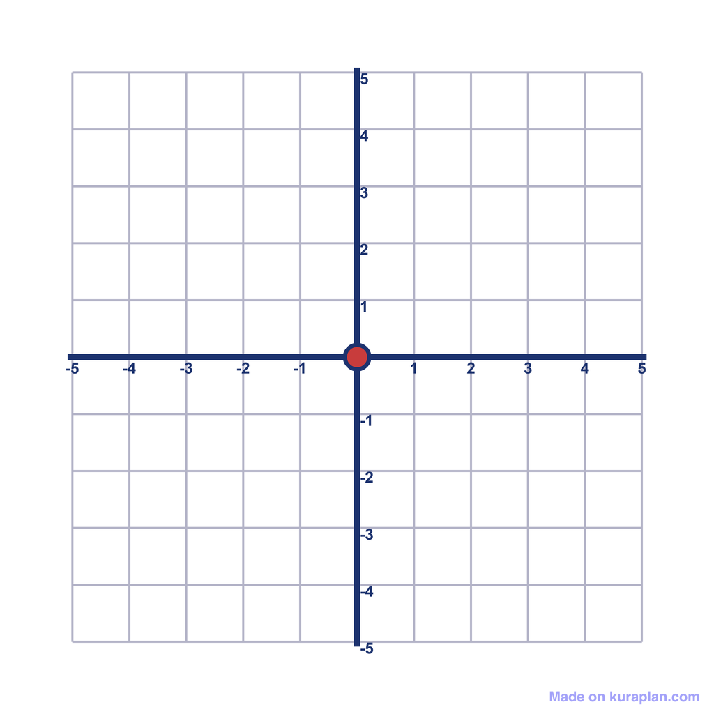
Quick Check: Where is Point A?
Look at the coordinate plane Point A is marked in red What are its coordinates? Remember: (x, y) format Discuss with your partner

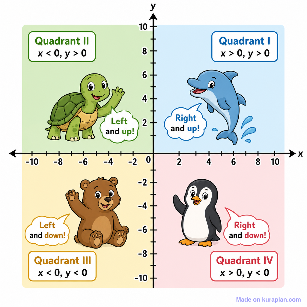
The Four Quadrants

Coordinate Treasure Hunt
Plot the given coordinates Connect the points in order What shape do you discover? Work in pairs to support each other Check your work with a neighbor

Real-World Applications
GPS navigation systems Video game character movement Architectural blueprints Mapping and surveying Computer graphics and animation Scientific data plotting

Reflection and Summary
'Mathematics is the language with which God has written the universe.' - Galileo Galilei Today we learned to read coordinates We explored the four quadrants We saw real-world applications Next lesson: Distance and midpoint formulas
Free Coordinates images
Drop these illustrations straight into your lesson.