
River Profiles for GCSE Geography
Understanding the Long Profile of a River From Source to Mouth Year 10 Geography

What is a River Profile?
A cross-sectional view of a river from source to mouth Shows how gradient, velocity, and discharge change Helps us understand river processes and landforms Essential for understanding river management
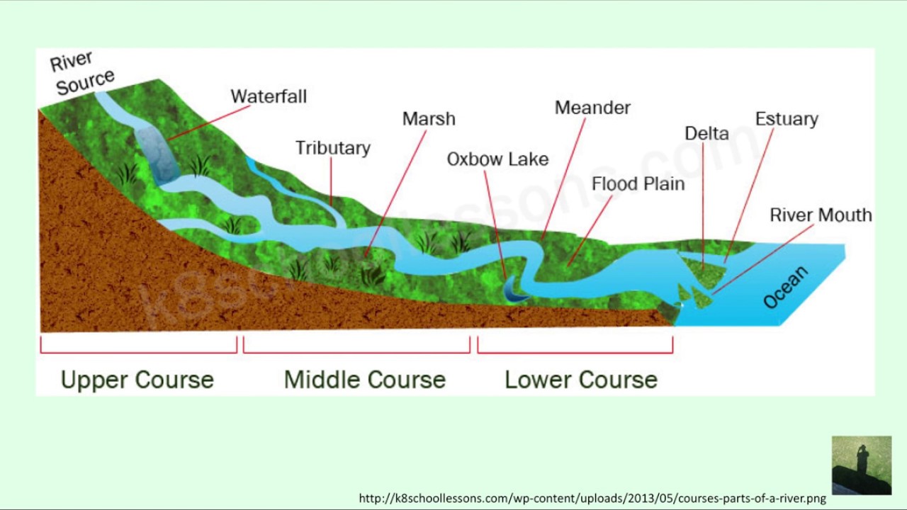
The Three Courses of a River
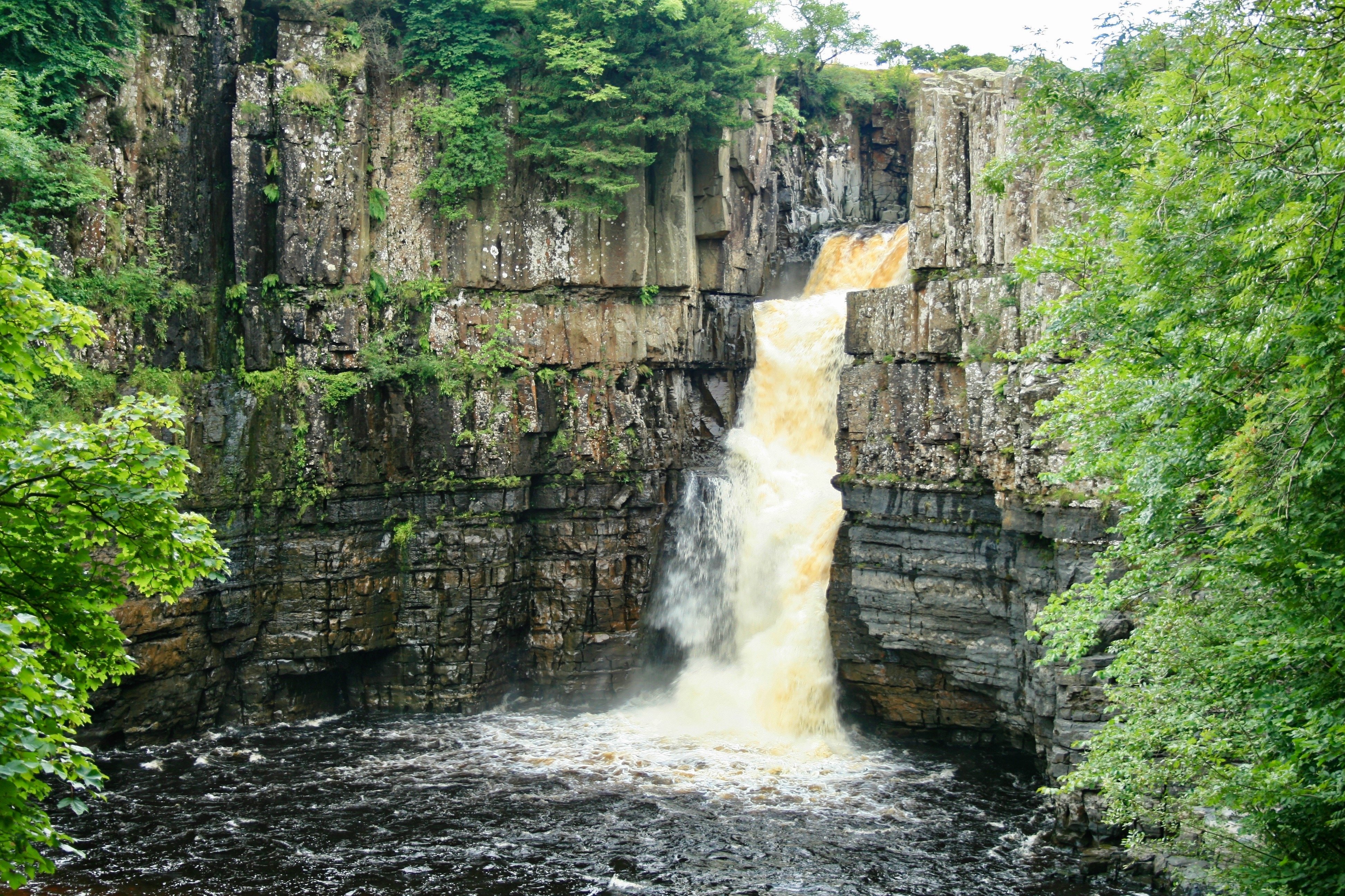
Upper Course Characteristics
Steep gradient and high energy Narrow, shallow channel Vertical erosion dominates Creates V-shaped valleys and waterfalls Low discharge but high velocity

River Profile Investigation
Using the OS map provided, trace the River Wye from source to mouth Identify examples of upper, middle, and lower course features Measure the gradient changes using spot heights Complete the river profile worksheet
Middle Course Characteristics
Moderate gradient and energy Wider, deeper channel Lateral erosion increases Meanders begin to form Increased discharge and load
Erosion vs Deposition Processes
{"left":"Hydraulic action - water pressure breaks rock\nAbrasion - rocks scrape riverbed\nAttrition - rocks collide and break\nSolution - chemical weathering","right":"Traction - large rocks roll along bed\nSaltation - smaller rocks bounce along\nSuspension - fine particles carried in water\nSolution - dissolved minerals transported"}

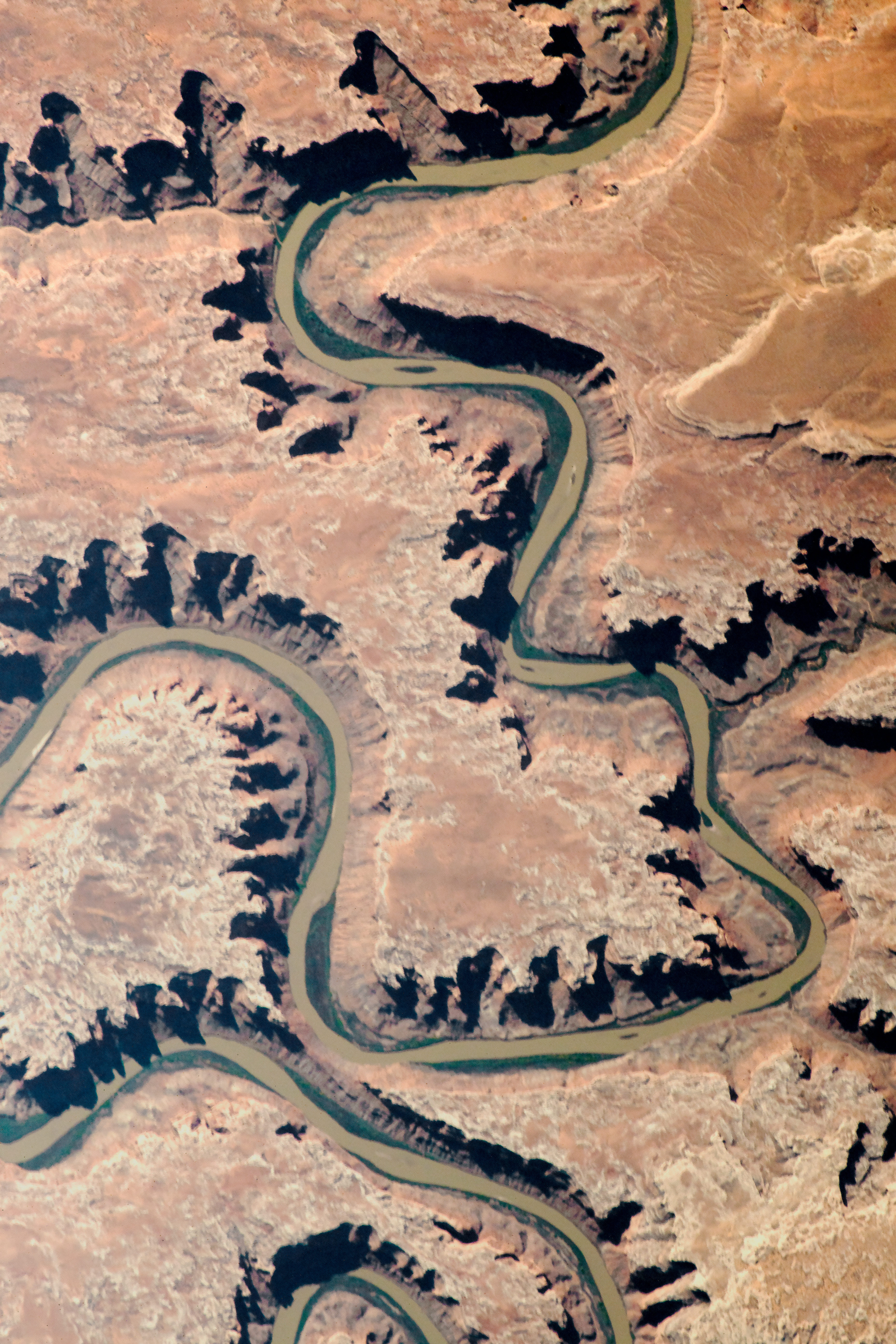
Lower Course Characteristics
Gentle gradient and low energy Wide, deep channel Deposition dominates Large meanders and oxbow lakes High discharge, low velocity
Quick Check Understanding
Why does a river's velocity actually INCREASE from source to mouth despite the gentler gradient? Think about: channel size, friction, discharge
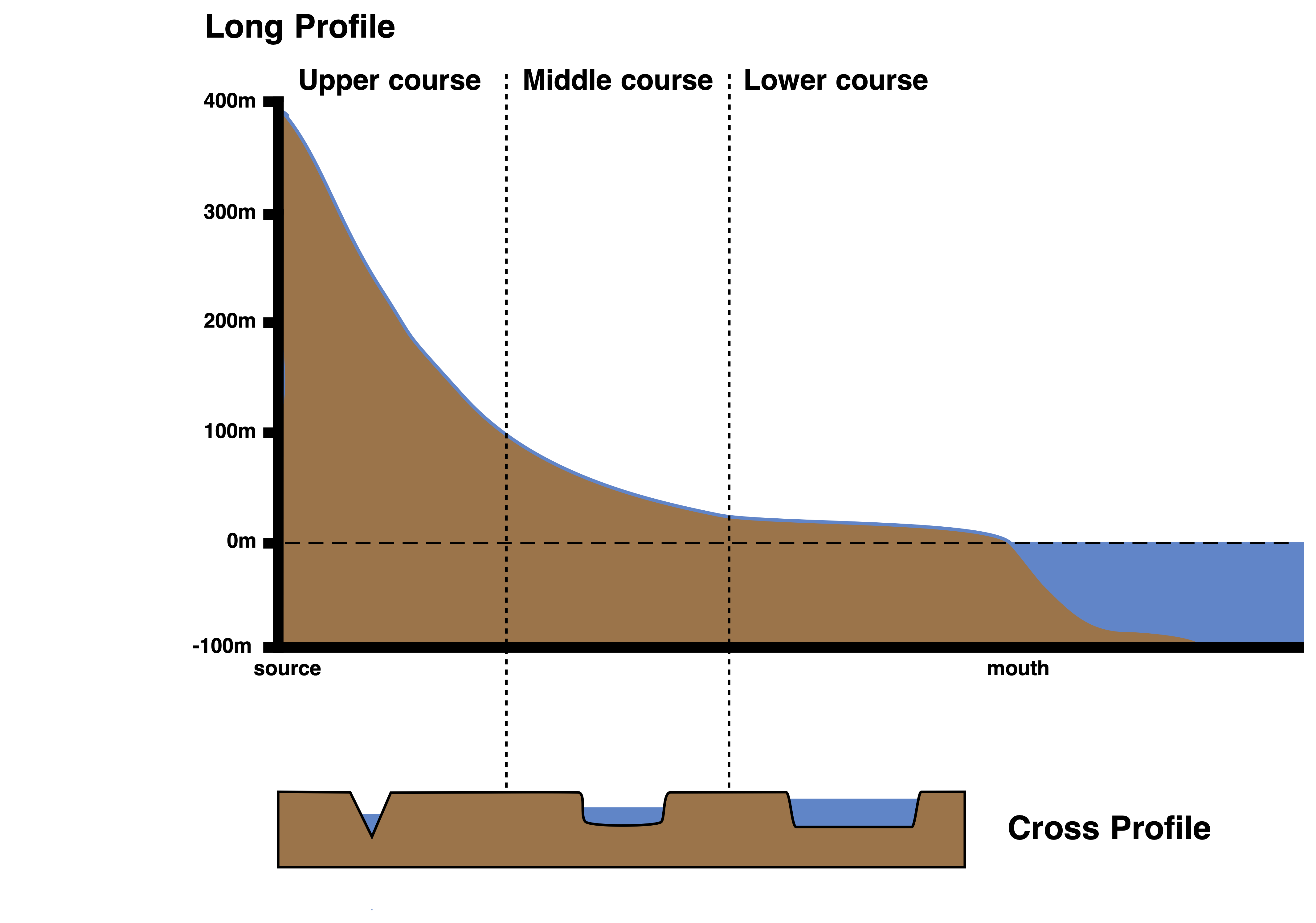
River Profile Summary
Upper course: steep, narrow, vertical erosion, V-shaped valleys Middle course: moderate gradient, meanders, lateral erosion Lower course: gentle, wide, deposition, floodplains Profile shape: concave curve from source to mouth Understanding profiles helps predict flooding and plan management