Cloud Types Chart Altitude — free printable diagram
Free geography resource for teachers · CC BY-NC 4.0
About this illustration
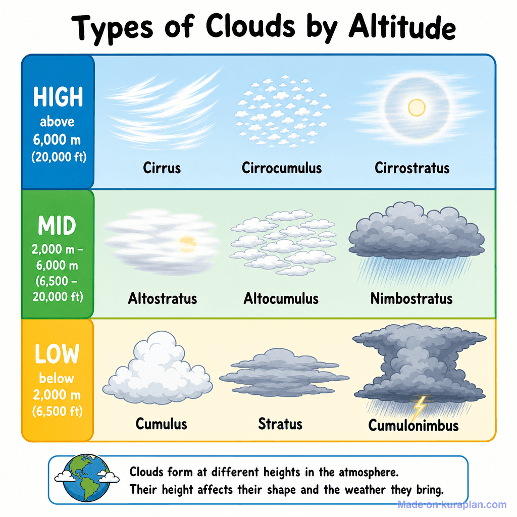
This educational diagram illustrates nine common cloud types, categorized into High, Mid, and Low altitude layers with corresponding meter and feet ranges. Each cloud type, including Cirrus, Cirrocumulus, Cirrostratus, Altostratus, Altocumulus, Nimbostratus, Cumulus, Stratus, and Cumulonimbus, is visually depicted with its name. An explanatory box at the bottom, featuring a small globe, provides context on cloud formation and their impact on weather. This flat illustration is ideal for K-12 Earth Science or meteorology lessons, suitable for slides, worksheets, or as a reference chart for classroom activities.
How to use
- 1Right-click the image and choose “Save image as”, or use the download button.
- 2Use it in your classroom worksheets, slides or printables — free under CC BY-NC 4.0.
- 3Attribute as “Image by Kuraplan” or link back to kuraplan.com. Not for commercial resale.
Make worksheets with images like this
Kuraplan's editor has the full image library built in — drag-and-drop into a worksheet in seconds.
Related illustrations
More from Weather & Climate


Browse by subject
10 subjects · 1,487 free illustrations


