Contour Lines Hill Diagram — free printable diagram
Free geography resource for teachers · CC BY-NC 4.0
About this illustration
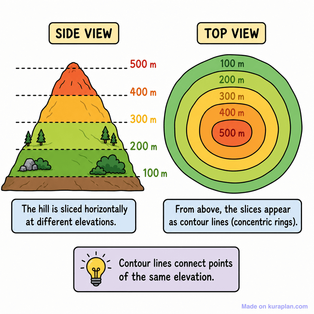
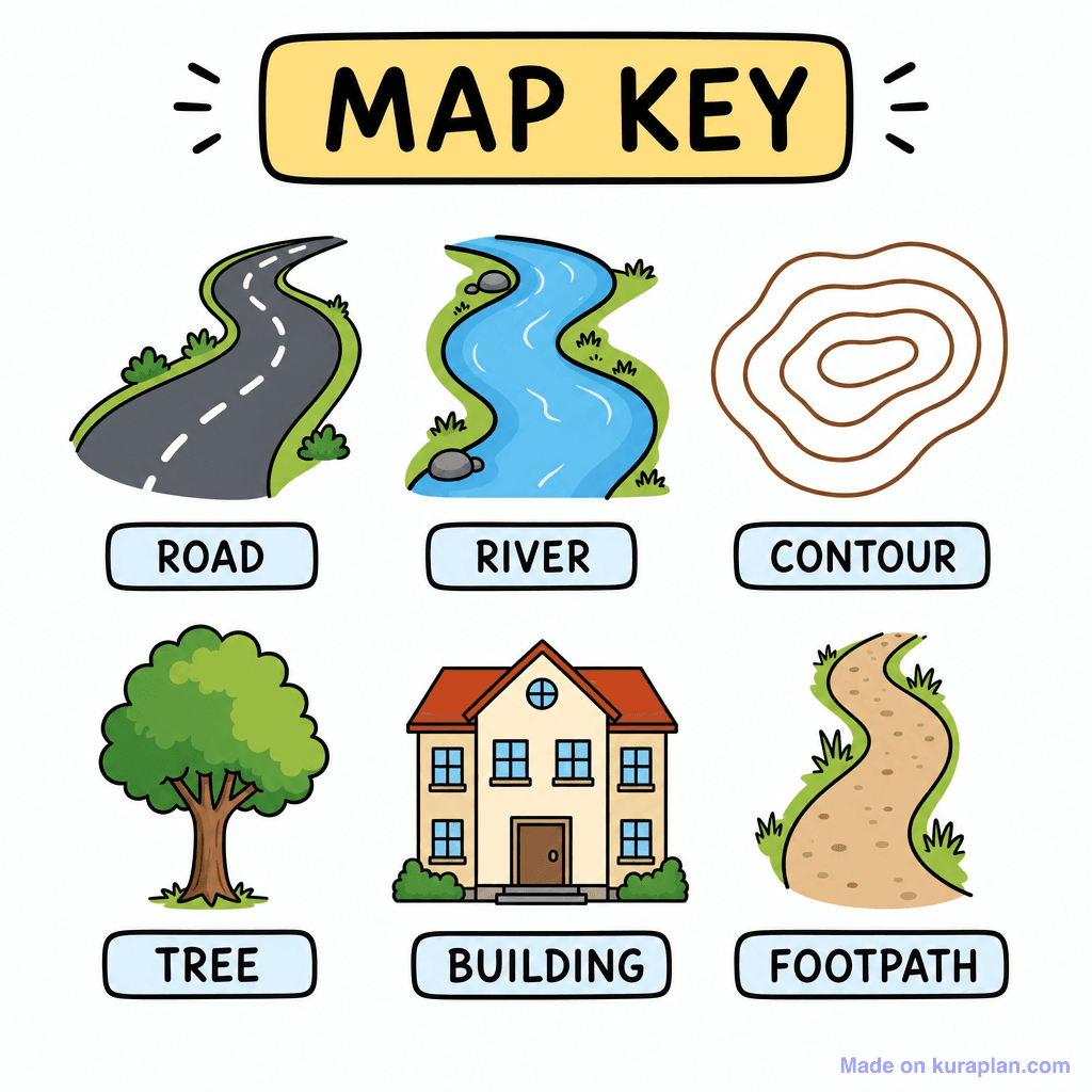
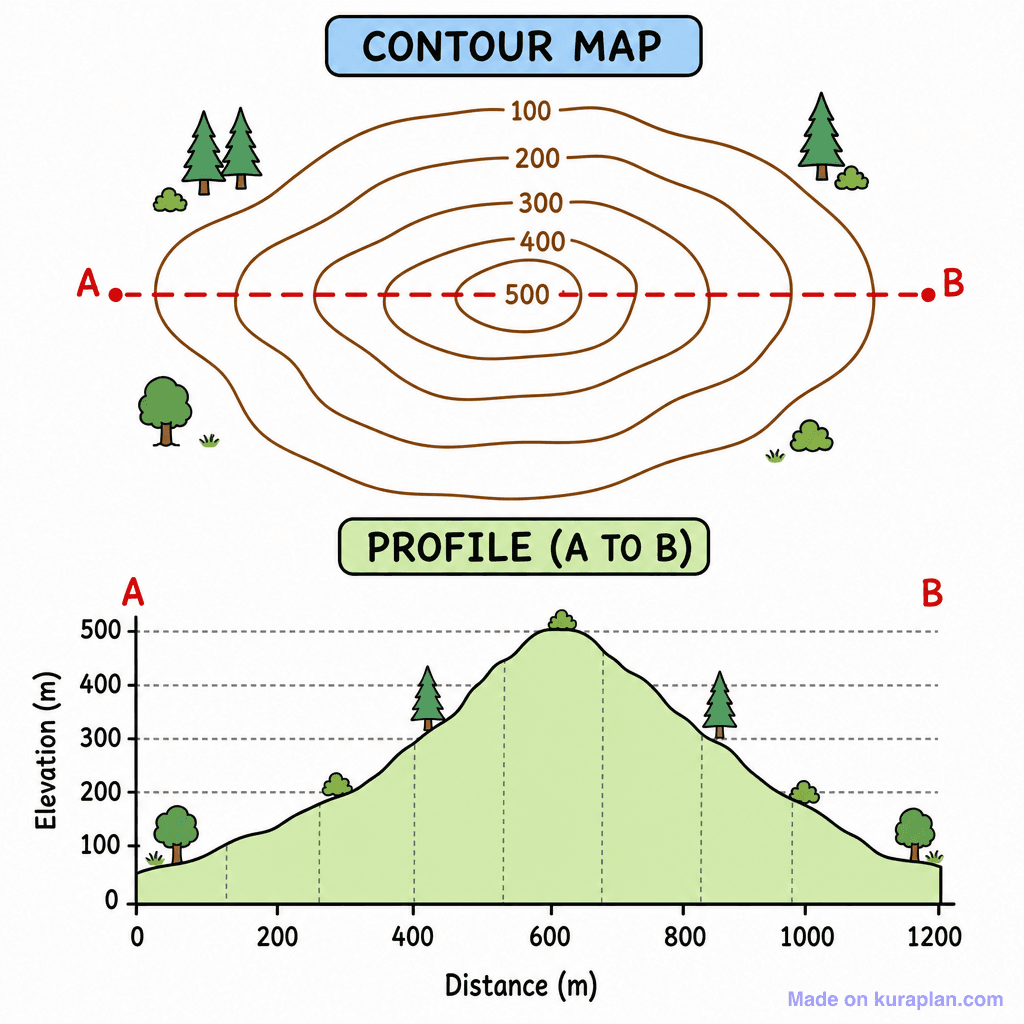
This diagram visually explains the concept of contour lines using a colorful hill. It features a 'SIDE VIEW' of a hill, horizontally sliced at elevations from 100m to 500m, depicted with trees and bushes. Alongside, a 'TOP VIEW' shows the hill as concentric rings, or contour lines, each labelled with the corresponding elevation. Explanatory text boxes read: 'The hill is sliced horizontally at different elevations.', 'From above, the slices appear as contour lines (concentric rings).', and 'Contour lines connect points of the same elevation.' This illustration is ideal for introducing topographic maps in geography or Earth science lessons, suitable for slides or worksheets. The visual style is a clear, flat, cartoon-like illustration.
How to use
- 1Right-click the image and choose “Save image as”, or use the download button.
- 2Use it in your classroom worksheets, slides or printables — free under CC BY-NC 4.0.
- 3Attribute as “Image by Kuraplan” or link back to kuraplan.com. Not for commercial resale.
Make worksheets with images like this
Kuraplan's editor has the full image library built in — drag-and-drop into a worksheet in seconds.
Related illustrations
More from Map Tools & Conventions
Browse by subject
10 subjects · 1,487 free illustrations


