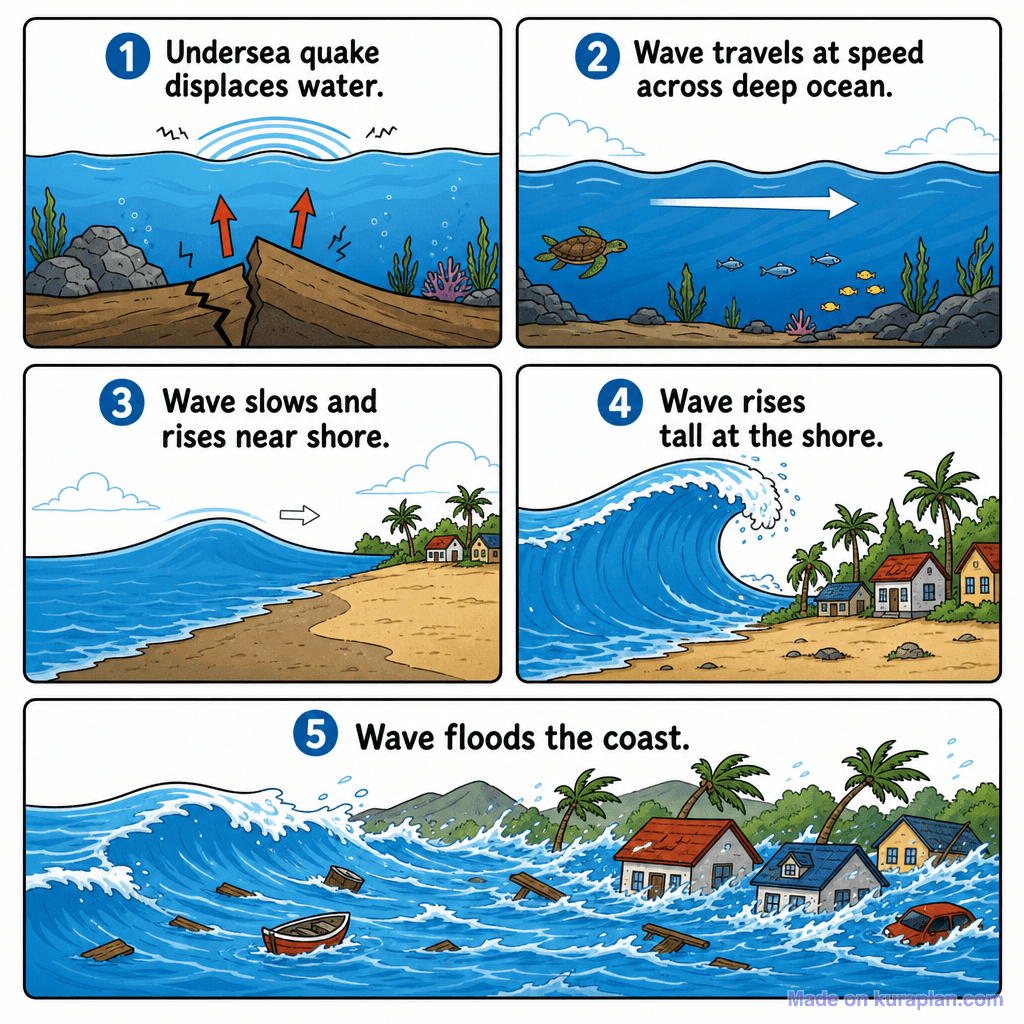
Earthquake Anatomy Diagram — free printable diagram
Free geography resource for teachers · CC BY-NC 4.0
About this illustration
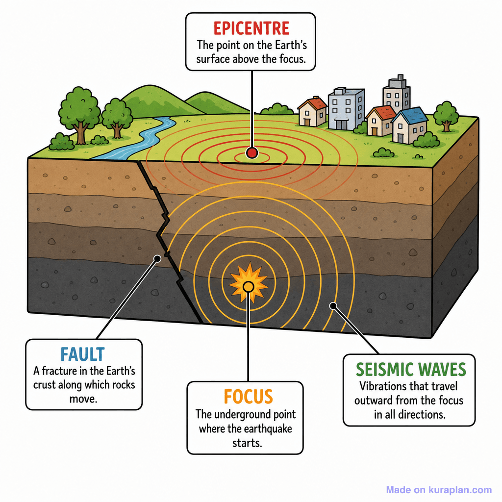
A flat illustration diagram depicts a cross-section of Earth's crust, revealing layers of rock and a fault line. The surface features a small town with houses, trees, a river, and hills. The diagram clearly labels and defines the 'EPICENTRE' (the point on the surface above the focus), the 'FAULT' (a fracture in the Earth's crust), the 'FOCUS' (the underground point where the earthquake starts), and 'SEISMIC WAVES' (vibrations traveling from the focus). This visual resource is ideal for teaching students about the anatomy and mechanics of earthquakes, suitable for classroom slides or educational worksheets.
How to use
- 1Right-click the image and choose “Save image as”, or use the download button.
- 2Use it in your classroom worksheets, slides or printables — free under CC BY-NC 4.0.
- 3Attribute as “Image by Kuraplan” or link back to kuraplan.com. Not for commercial resale.
Make worksheets with images like this
Kuraplan's editor has the full image library built in — drag-and-drop into a worksheet in seconds.
Related illustrations
More from Mountains & Tectonics

Browse by subject
10 subjects · 1,487 free illustrations


