Re Pilgrimage Camino Santiago — free printable clipart
Free religious education resource for teachers · CC BY-NC 4.0
About this illustration
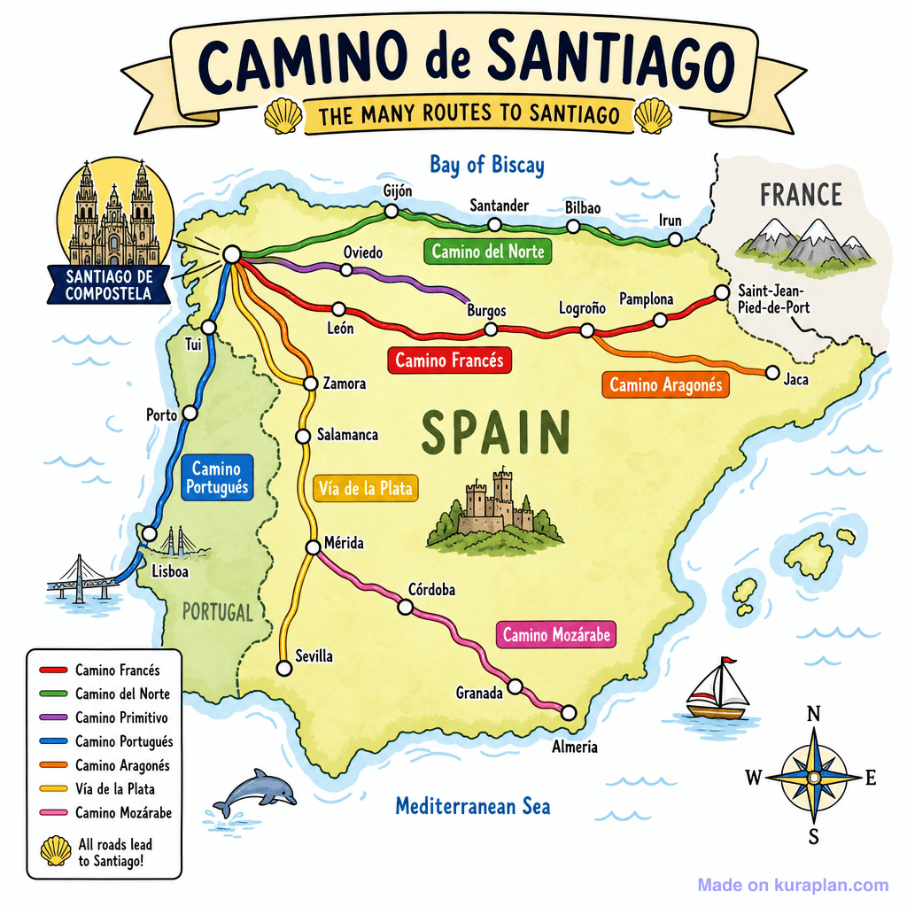
This vibrant, illustrative map depicts the Iberian Peninsula, specifically showcasing the various routes of the Camino de Santiago across Spain and Portugal. Each pilgrimage path, including Camino Francés, Camino del Norte, and Vía de la Plata, is clearly marked with a distinct color, originating from different cities like Lisbon, Pamplona, and Saint-Jean-Pied-de-Port, and all converging on Santiago de Compostela. The image teaches European geography, historical pilgrimage routes, and map reading skills, providing clear cultural cues related to this significant Spanish and Portuguese heritage. It is well-suited for classroom use on a slide presentation, as part of a geography worksheet, or for reference during a social studies lesson. The visual style is a colourful, flat illustration with a charming, hand-drawn aesthetic and decorative elements.
How to use
- 1Right-click the image and choose “Save image as”, or use the download button.
- 2Use it in your classroom worksheets, slides or printables — free under CC BY-NC 4.0.
- 3Attribute as “Image by Kuraplan” or link back to kuraplan.com. Not for commercial resale.
Make worksheets with images like this
Kuraplan's editor has the full image library built in — drag-and-drop into a worksheet in seconds.
Related illustrations
More from Comparative & Big Questions


Browse by subject
10 subjects · 1,514 free illustrations