River Full Diagram Source To Mouth — free printable diagram
Free geography resource for teachers · CC BY-NC 4.0
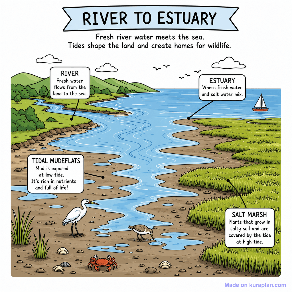
About this illustration
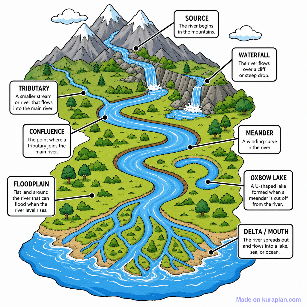
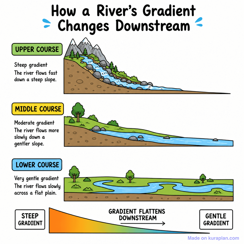
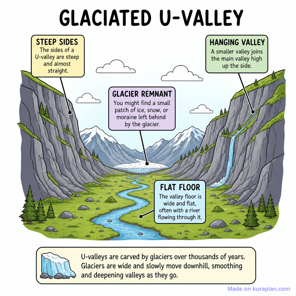
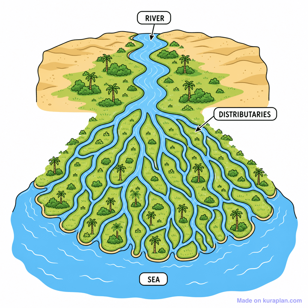
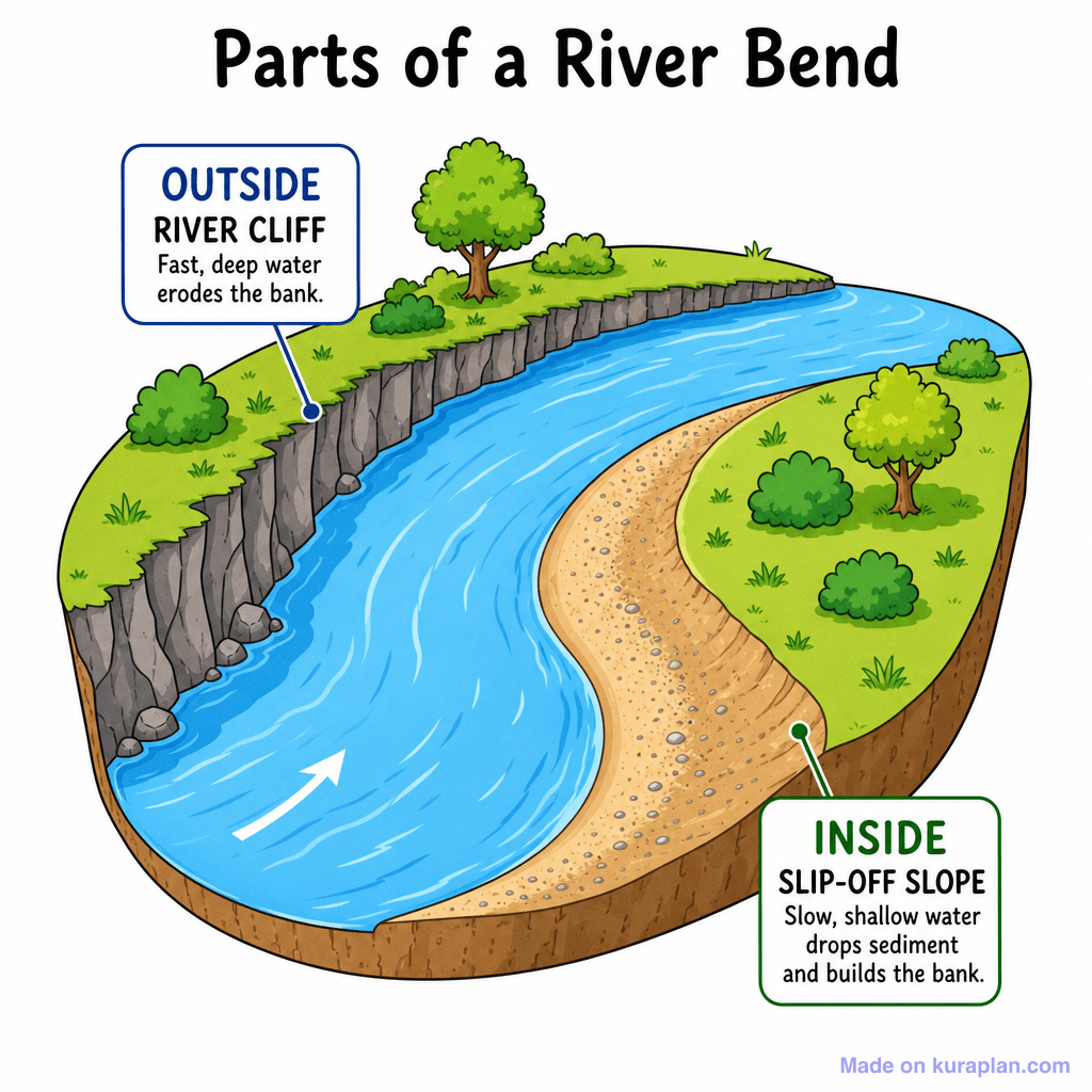
This colorful, flat-style illustration diagrams a complete river system, tracing its path from a mountain source through various stages to a delta at the river mouth. Key geographical features such as waterfalls, tributaries, confluences, meanders, oxbow lakes, and floodplains are clearly labelled with accompanying definitions, making it an excellent resource for teaching physical geography concepts. The illustration does not contain any specific cultural or locale cues. Suitable for K-12 worksheets, slide presentations, or label exercises, this educational image helps students understand river processes and landforms. The visual style is a decorative, cartoon-like scene.
How to use
- 1Right-click the image and choose “Save image as”, or use the download button.
- 2Use it in your classroom worksheets, slides or printables — free under CC BY-NC 4.0.
- 3Attribute as “Image by Kuraplan” or link back to kuraplan.com. Not for commercial resale.
Make worksheets with images like this
Kuraplan's editor has the full image library built in — drag-and-drop into a worksheet in seconds.
Related illustrations
More from Rivers & Water Features
Browse by subject
10 subjects · 1,487 free illustrations


