Urban Rural Fringe — free printable diagram
Free geography resource for teachers · CC BY-NC 4.0
About this illustration
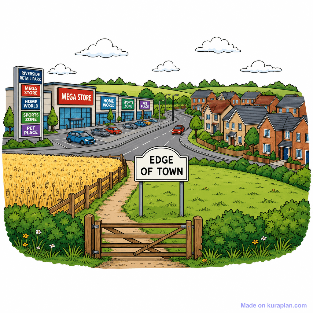
A vibrant cartoon-style illustration depicts the 'Edge of Town', featuring a bustling retail park on the left with prominent stores like 'Mega Store' and 'Home World', contrasting with a residential area of modern houses on the right. A main road separates these two areas, with a foreground displaying a wheat field, wooden gate, and green grassy hills. A sign reading 'EDGE OF TOWN' stands prominently in the foreground. This image is suitable for teaching human geography concepts such as urban vs. rural environments, land use, and settlement patterns, particularly relevant to UK or Western European contexts. It can be used in worksheets, slides, or as a discussion prompt in geography lessons.
How to use
- 1Right-click the image and choose “Save image as”, or use the download button.
- 2Use it in your classroom worksheets, slides or printables — free under CC BY-NC 4.0.
- 3Attribute as “Image by Kuraplan” or link back to kuraplan.com. Not for commercial resale.
Make worksheets with images like this
Kuraplan's editor has the full image library built in — drag-and-drop into a worksheet in seconds.
Related illustrations
More from Settlement & Urban


Browse by subject
10 subjects · 1,487 free illustrations


