MathsFreePrintable

Compass and Map Navigation

A free maths worksheet ready for your classroom. Open in Kuraplan to grab the print-ready PDF, customize it for your students, or generate a fresh version in seconds.

Compass and Map Navigation worksheet preview
Compass and Map Navigation

Compass and Map Navigation

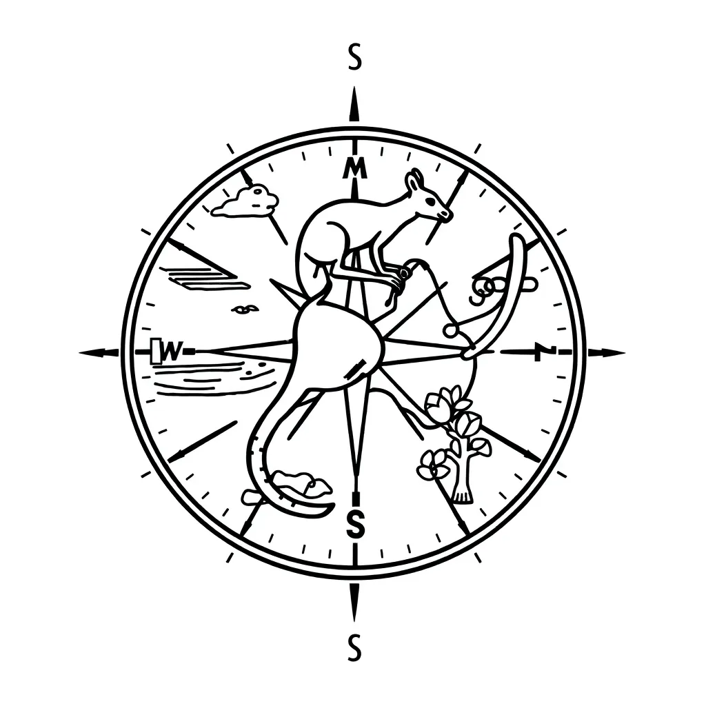
Compass and map illustration

🧭 Part 1: Understanding the Compass

1. Label the parts of a compass by filling in the blanks:

The magnetic __________ always points to magnetic north. The __________ __________ shows the four main directions. The outer __________ holds all the parts together.

2. Circle the correct answer - Which direction does the red end of a compass needle point to?

South

North

East

West

3. Check all the main compass directions:

North

Northeast

South

East

Southwest

West

🗺️ Part 2: Reading Grid References

4. Explain how to read a grid reference on a map:
5. Fill in the blanks about grid references:

When reading a grid reference, you read the __________ line first (across), then the __________ line second (up). Remember: "Along the corridor, up the stairs!"

6. Circle the correct order for reading grid references:

Vertical first, then horizontal

Horizontal first, then vertical

It doesn't matter which order

📍 Part 3: Map Grid Practice

7. Using the grid below, write the grid reference for each landmark:

School: Grid reference ____

Lake: Grid reference ____

Bridge: Grid reference ____

Forest: Grid reference ____

8. Draw a simple compass rose showing the four main directions:

🧭 Part 4: Navigation Skills

9. Match the compass bearing with the correct direction:
1. 0° (360°)
2. 90°
3. 180°
4. 270°
A. South
B. West
C. North
D. East
10. You are at grid reference 34. You need to travel to grid reference 56. Describe the direction you would travel:
11. Check all the tools that would help you navigate using a map:

Compass

Ruler

Calculator

Pencil

Grid reference key

🎯 Part 5: Problem Solving

12. A hiker is lost and needs to find their way back to camp. They have a compass and a map with grid lines. List three steps they should take:
13. Why is it important to hold a compass flat and away from metal objects?
14. Calculate the distance: If each grid square represents 1 kilometre, and you travel 3 squares east and 4 squares north, what is the total distance travelled?

Total distance: _______ kilometres

About This Worksheet

Free in Kuraplan

Sign up free, grab the PDF, and customize it for your class.

Print-Ready

Formatted for standard paper. Clean layout, easy to read.

AI-Generated

Created with Kuraplan's AI, designed for real classroom use.

For Teachers & Parents

Use in classrooms, for homework, tutoring, or homeschool.

Need a custom version of this worksheet?

Kuraplan's AI generates custom worksheets in seconds — differentiated for every learner, aligned to your curriculum.

Generate Custom Worksheets — Free
No credit card Curriculum-aligned Under 60 seconds