Coast Deposition Features — free printable diagram
Free geography resource for teachers · CC BY-NC 4.0
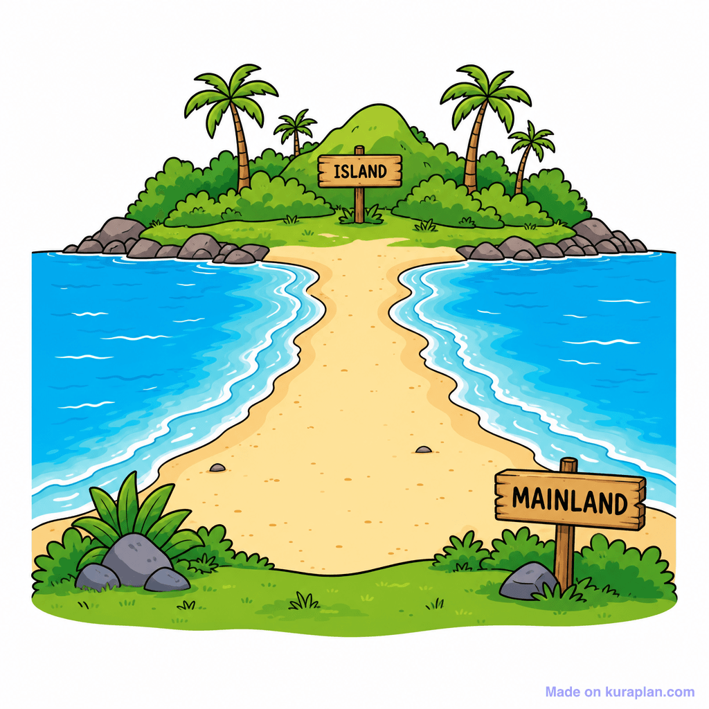
About this illustration
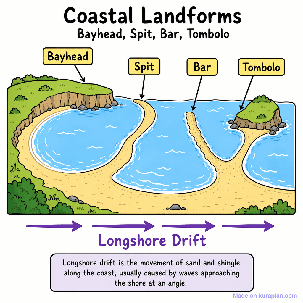
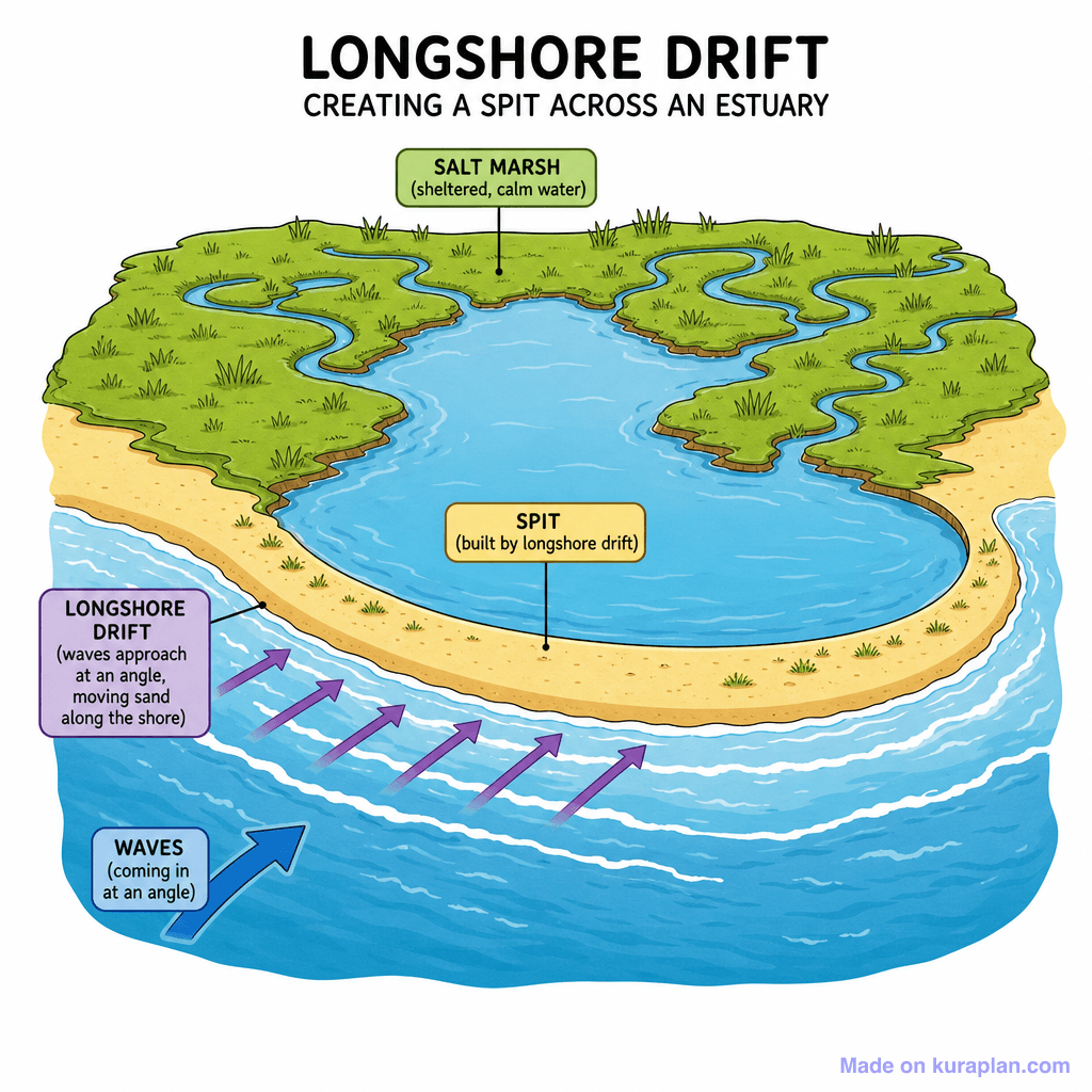
This educational illustration depicts various coastal landforms and the process of longshore drift. The image concretely shows a bay with sandy beaches and water, with labels pointing to a 'Bayhead' (the headland), a 'Spit' (a sandy projection from the coast), a 'Bar' (a sand ridge connecting two headlands), and a 'Tombolo' (a sand bridge connecting an island to the mainland). Purple arrows across the bottom indicate 'Longshore Drift,' which is defined in a text box as 'the movement of sand and shingle along the coast, usually caused by waves approaching the shore at an angle.' This resource is suitable for teaching physical geography concepts in K-12 classrooms, ideal for worksheets, slides, or as a visual reference for label exercises. The visual style is a flat, cartoon-like illustration with clear labeling.
How to use
- 1Right-click the image and choose “Save image as”, or use the download button.
- 2Use it in your classroom worksheets, slides or printables — free under CC BY-NC 4.0.
- 3Attribute as “Image by Kuraplan” or link back to kuraplan.com. Not for commercial resale.
Make worksheets with images like this
Kuraplan's editor has the full image library built in — drag-and-drop into a worksheet in seconds.
Related illustrations
More from Coastal Features
Browse by subject
10 subjects · 1,487 free illustrations


