Longshore Drift Aerial — free printable diagram
Free geography resource for teachers · CC BY-NC 4.0
About this illustration
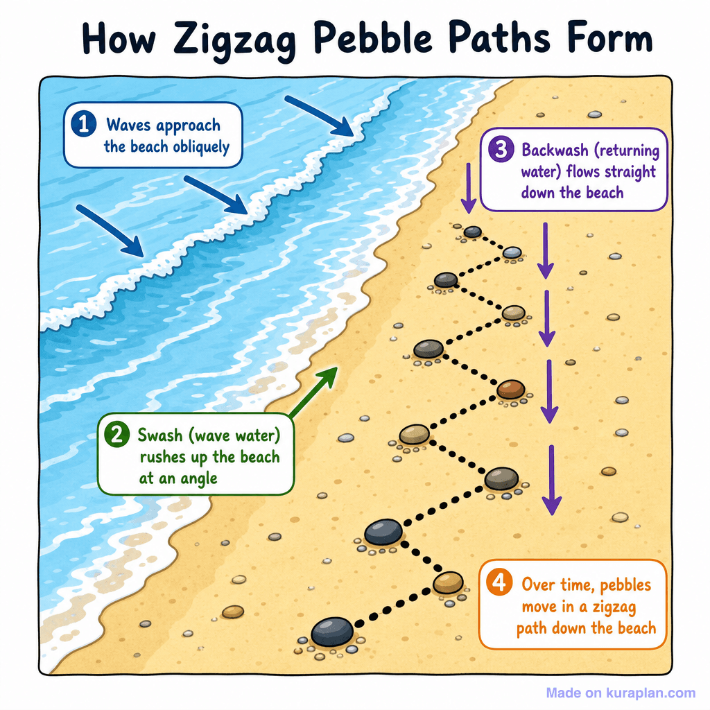
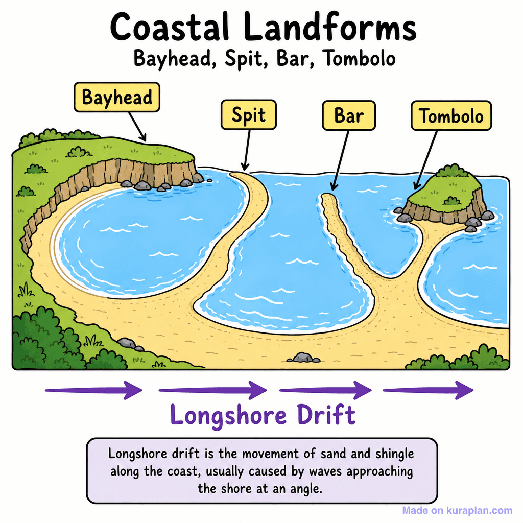
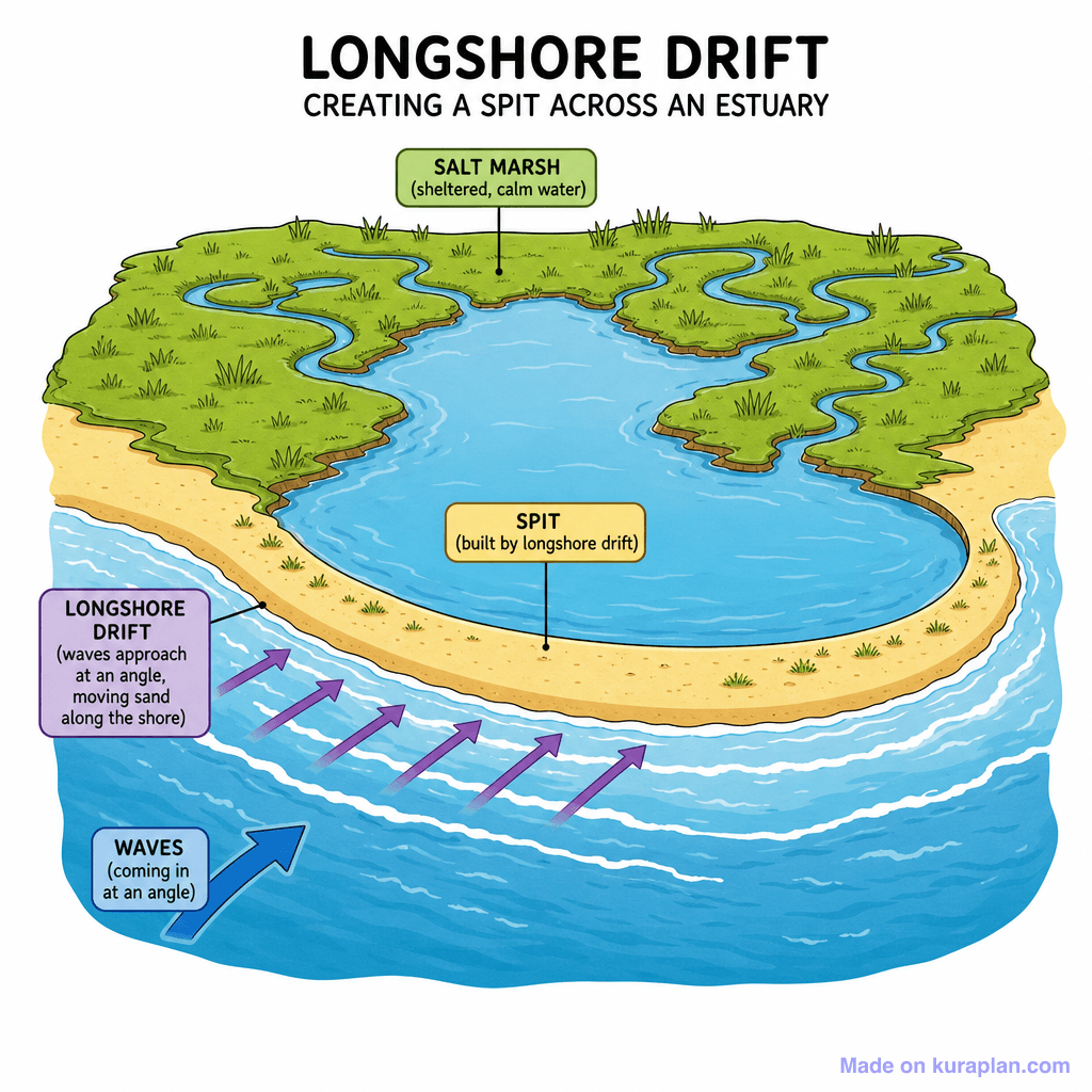
This vibrant, labeled diagram illustrates the geological process of how zigzag pebble paths form on a beach due to wave action. It visually breaks down the steps: waves approaching obliquely, swash moving up the beach at an angle, backwash flowing straight down, and the resulting zigzag movement of pebbles over time. This clear explanation is suitable for slides or worksheets in Earth science or geography lessons, helping students understand coastal processes. The style is a flat, cartoon-like illustration of a beach scene with descriptive text boxes and directional arrows.
How to use
- 1Right-click the image and choose “Save image as”, or use the download button.
- 2Use it in your classroom worksheets, slides or printables — free under CC BY-NC 4.0.
- 3Attribute as “Image by Kuraplan” or link back to kuraplan.com. Not for commercial resale.
Make worksheets with images like this
Kuraplan's editor has the full image library built in — drag-and-drop into a worksheet in seconds.
Related illustrations
More from Coastal Features
Browse by subject
10 subjects · 1,487 free illustrations


