Continent Asia — free printable diagram
Free geography resource for teachers · CC BY-NC 4.0
About this illustration
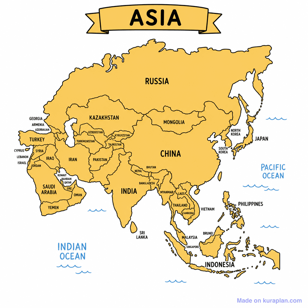
This image displays a flat-style political map of the continent of Asia, clearly outlining and labelling 49 countries including Russia, China, India, and Japan, along with the surrounding Indian and Pacific Oceans. It serves to teach K-12 students about Asian geography, political boundaries, and country identification. The map is presented in a general educational style, making it suitable for any curriculum focusing on world geography. This resource is perfect for classroom activities such as geography worksheets, slide presentations on continents, or as a reference for labeling exercises. Its high-contrast, flat illustration style with clear black outlines and a mustard yellow fill ensures readability and ease of understanding.
How to use
- 1Right-click the image and choose “Save image as”, or use the download button.
- 2Use it in your classroom worksheets, slides or printables — free under CC BY-NC 4.0.
- 3Attribute as “Image by Kuraplan” or link back to kuraplan.com. Not for commercial resale.
Make worksheets with images like this
Kuraplan's editor has the full image library built in — drag-and-drop into a worksheet in seconds.
Related illustrations
More from Continent Outlines

Browse by subject
10 subjects · 1,487 free illustrations


