Continent Oceania — free printable diagram
Free geography resource for teachers · CC BY-NC 4.0
About this illustration
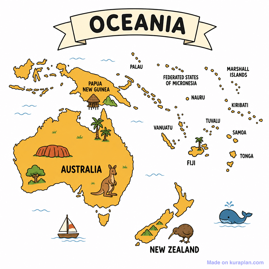
A vibrant, cartoon-style map illustrates the continent of Oceania, prominently featuring Australia and New Zealand alongside numerous Pacific Island nations. Key geographical areas are clearly labeled, including Papua New Guinea, Palau, Federated States of Micronesia, Nauru, Marshall Islands, Kiribati, Tuvalu, Samoa, Tonga, Vanuatu, and Fiji. The map is enriched with iconic visual cues such as Uluru and a kangaroo for Australia, a kiwi bird for New Zealand, palm trees and a traditional hut representing island culture, and a whale in the ocean. This decorative, flat illustration is ideal for introducing Oceania geography in K-12 classrooms, suitable for worksheets, slide presentations, or label exercises.
How to use
- 1Right-click the image and choose “Save image as”, or use the download button.
- 2Use it in your classroom worksheets, slides or printables — free under CC BY-NC 4.0.
- 3Attribute as “Image by Kuraplan” or link back to kuraplan.com. Not for commercial resale.
Make worksheets with images like this
Kuraplan's editor has the full image library built in — drag-and-drop into a worksheet in seconds.
Related illustrations
More from Continent Outlines
Browse by subject
10 subjects · 1,487 free illustrations


