Plate Divergent Rift Valley — free printable diagram
Free geography resource for teachers · CC BY-NC 4.0
About this illustration
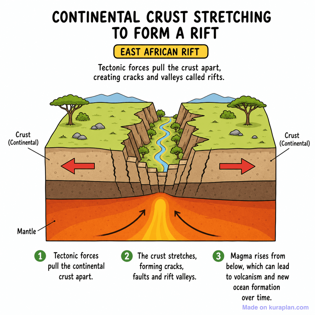
The image is a colorful cross-section diagram illustrating the geological process of continental crust stretching to form a rift valley. It depicts the Earth's continental crust being pulled apart by opposing red arrows, revealing cracks and faults that create a deep valley with a river, flanked by trees and distant mountains. Below the crust, the mantle is shown with magma rising towards the surface, and numbered steps (1-3) explain the process. This diagram teaches about divergent plate boundaries, the formation of rift valleys, and the initial stages of new ocean basin formation, using the East African Rift as a specific example. It is ideal for use on classroom slides or as a reference image on worksheets for earth science or geography lessons, clearly explaining a complex geological process. The visual style is a clear, flat-style educational illustration with a cross-section view, featuring cartoon-like environmental elements and high-contrast colors for different geological layers and processes.
How to use
- 1Right-click the image and choose “Save image as”, or use the download button.
- 2Use it in your classroom worksheets, slides or printables — free under CC BY-NC 4.0.
- 3Attribute as “Image by Kuraplan” or link back to kuraplan.com. Not for commercial resale.
Make worksheets with images like this
Kuraplan's editor has the full image library built in — drag-and-drop into a worksheet in seconds.
Related illustrations
More from Mountains & Tectonics
Browse by subject
10 subjects · 1,487 free illustrations


