Interactive Ecosystem Mapping
A free geography worksheet ready for your classroom. Open in Kuraplan to grab the print-ready PDF, customize it for your students, or generate a fresh version in seconds.
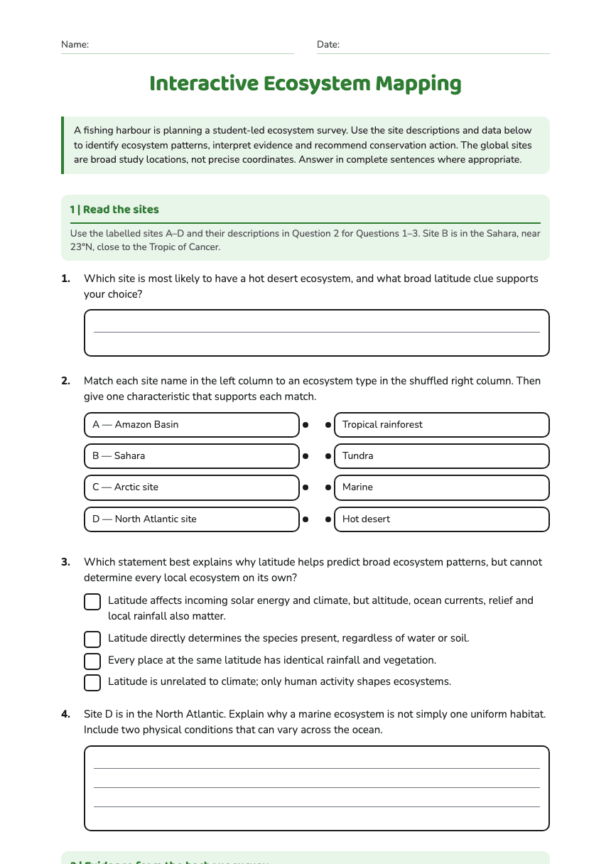
Interactive Ecosystem Mapping
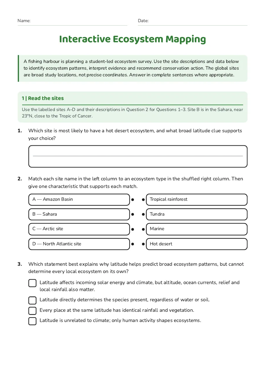
1 | Read the sites
Use the labelled sites A–D and their descriptions in Question 2 for Questions 1–3. Site B is in the Sahara, near 23°N, close to the Tropic of Cancer.
- A — Amazon Basin
- B — Sahara
- C — Arctic site
- D — North Atlantic site
- Tropical rainforest
- Tundra
- Marine
- Hot desert
- Latitude affects incoming solar energy and climate, but altitude, ocean currents, relief and local rainfall also matter.
- Latitude directly determines the species present, regardless of water or soil.
- Every place at the same latitude has identical rainfall and vegetation.
- Latitude is unrelated to climate; only human activity shapes ecosystems.
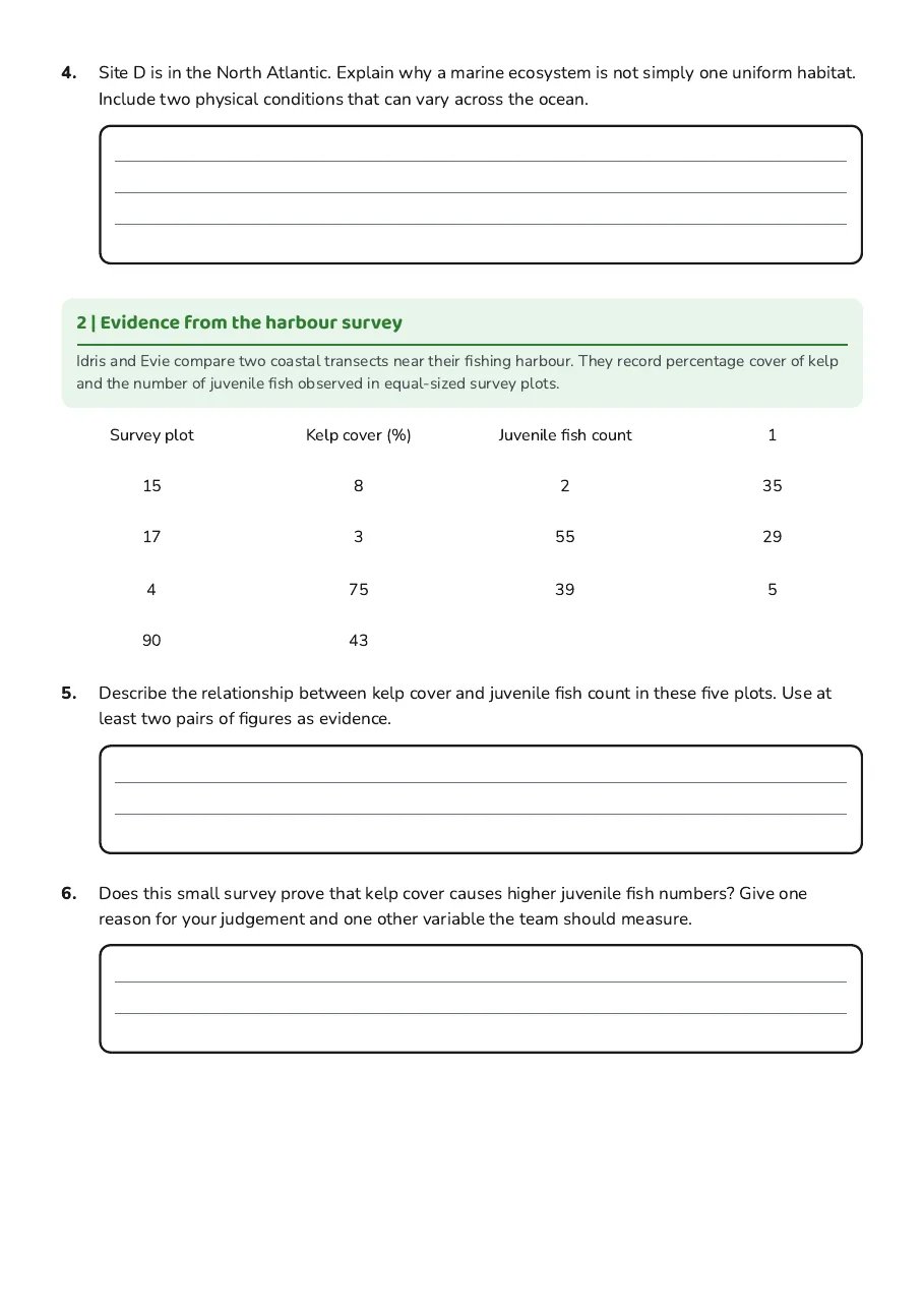
2 | Evidence from the harbour survey
Idris and Evie compare two coastal transects near their fishing harbour. They record percentage cover of kelp and the number of juvenile fish observed in equal-sized survey plots.
Survey plot
Kelp cover (%)
Juvenile fish count
1
15
8
2
35
17
3
55
29
4
75
39
5
90
43
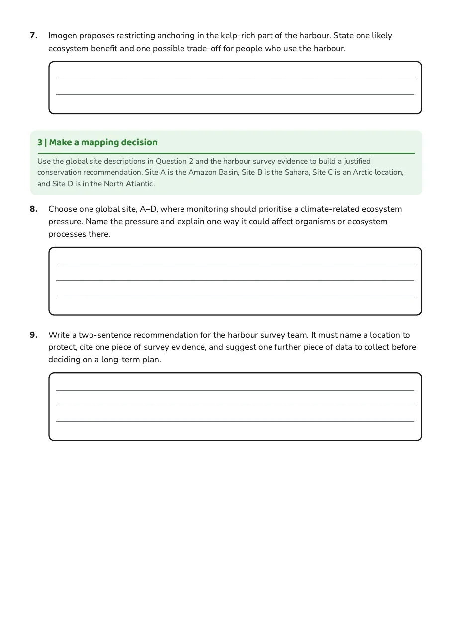
3 | Make a mapping decision
Use the global site descriptions in Question 2 and the harbour survey evidence to build a justified conservation recommendation. Site A is the Amazon Basin, Site B is the Sahara, Site C is an Arctic location, and Site D is in the North Atlantic.
3 printable pages
Page 1
Page 2
Page 3
About This Worksheet
Free in Kuraplan
Sign up free, grab the PDF, and customize it for your class.
Print-Ready
Formatted for standard paper. Clean layout, easy to read.
AI-Generated
Created with Kuraplan's AI, designed for real classroom use.
For Teachers & Parents
Use in classrooms, for homework, tutoring, or homeschool.
Need a custom version of this worksheet?
Kuraplan's AI generates custom worksheets in seconds — differentiated for every learner, aligned to your curriculum.
Generate Custom Worksheets — Free