Au States Territories — free printable diagram
Free geography resource for teachers · CC BY-NC 4.0
About this illustration
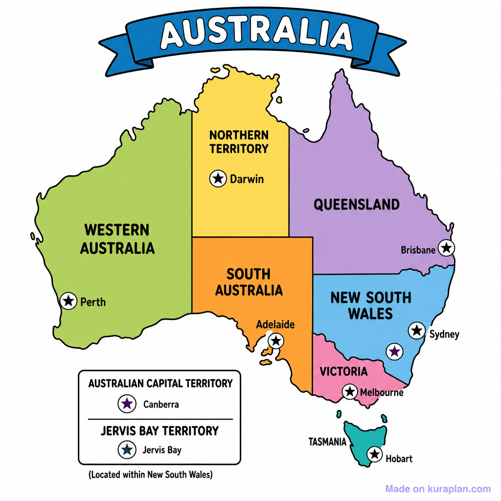
This image displays a colorful political map of Australia, clearly outlining and naming its six states and two major mainland territories: Western Australia, Northern Territory, Queensland, South Australia, New South Wales, Victoria, and Tasmania. Each state and territory is depicted in a distinct color and includes its capital city, marked by a star symbol and named (e.g., Perth, Darwin, Brisbane, Sydney, Melbourne, Adelaide, Hobart). A separate text box details the Australian Capital Territory (Canberra) and Jervis Bay Territory (Jervis Bay). This educational illustration is ideal for teaching Australian geography, political divisions, and capital cities, suitable for use on worksheets, slides, or as a labeling exercise in K-12 classrooms.
How to use
- 1Right-click the image and choose “Save image as”, or use the download button.
- 2Use it in your classroom worksheets, slides or printables — free under CC BY-NC 4.0.
- 3Attribute as “Image by Kuraplan” or link back to kuraplan.com. Not for commercial resale.
Make worksheets with images like this
Kuraplan's editor has the full image library built in — drag-and-drop into a worksheet in seconds.
Related illustrations
More from Regional / Political Subdivisions
Browse by subject
10 subjects · 1,487 free illustrations


