Canada Provinces Territories — free printable diagram
Free geography resource for teachers · CC BY-NC 4.0
About this illustration
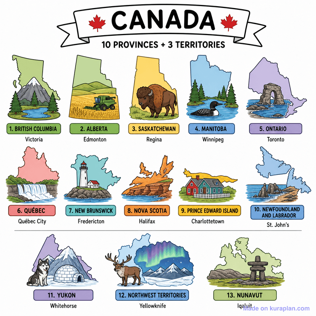
This vibrant, cartoon-style illustration provides an overview of Canada's 10 provinces and 3 territories. Each region is depicted with its distinctive map outline and a representative visual element, such as mountains for British Columbia, a combine harvester for Alberta, or an inuksuk for Nunavut. Underneath each illustration, the province or territory name (e.g., "1. BRITISH COLUMBIA") is listed along with its capital city (e.g., "Victoria"). This educational resource is ideal for teaching Canadian geography and civics in a K-12 classroom, perfect for a slide presentation, a labeling exercise, or a reference on a worksheet.
How to use
- 1Right-click the image and choose “Save image as”, or use the download button.
- 2Use it in your classroom worksheets, slides or printables — free under CC BY-NC 4.0.
- 3Attribute as “Image by Kuraplan” or link back to kuraplan.com. Not for commercial resale.
Make worksheets with images like this
Kuraplan's editor has the full image library built in — drag-and-drop into a worksheet in seconds.
Related illustrations
More from Regional / Political Subdivisions
Browse by subject
10 subjects · 1,487 free illustrations


