Uk Four Countries — free printable diagram
Free geography resource for teachers · CC BY-NC 4.0
About this illustration
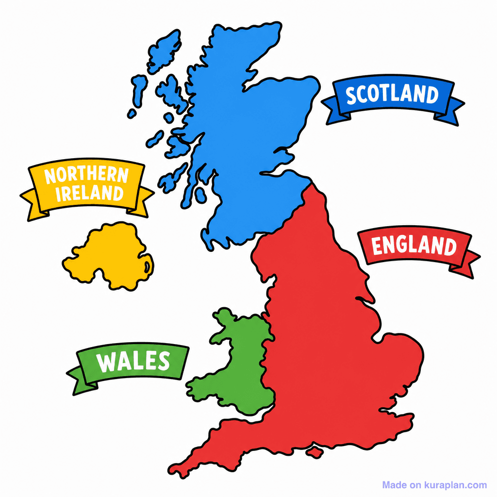
This image presents a simplified, colorful map of the United Kingdom, clearly outlining its four constituent countries. England is depicted in red, Scotland in blue, Wales in green, and Northern Ireland in yellow, each with a corresponding labeled banner. It is designed to teach students about the geography and political divisions of the UK. This flat illustration is suitable for classroom activities such as worksheets, slide presentations, or labeling exercises in a UK or European geography unit.
How to use
- 1Right-click the image and choose “Save image as”, or use the download button.
- 2Use it in your classroom worksheets, slides or printables — free under CC BY-NC 4.0.
- 3Attribute as “Image by Kuraplan” or link back to kuraplan.com. Not for commercial resale.
Make worksheets with images like this
Kuraplan's editor has the full image library built in — drag-and-drop into a worksheet in seconds.
Related illustrations
More from Regional / Political Subdivisions
Browse by subject
10 subjects · 1,487 free illustrations


