Polynesian navigation routes — free printable clipart
Free history resource for teachers · CC BY-NC 4.0
About this illustration
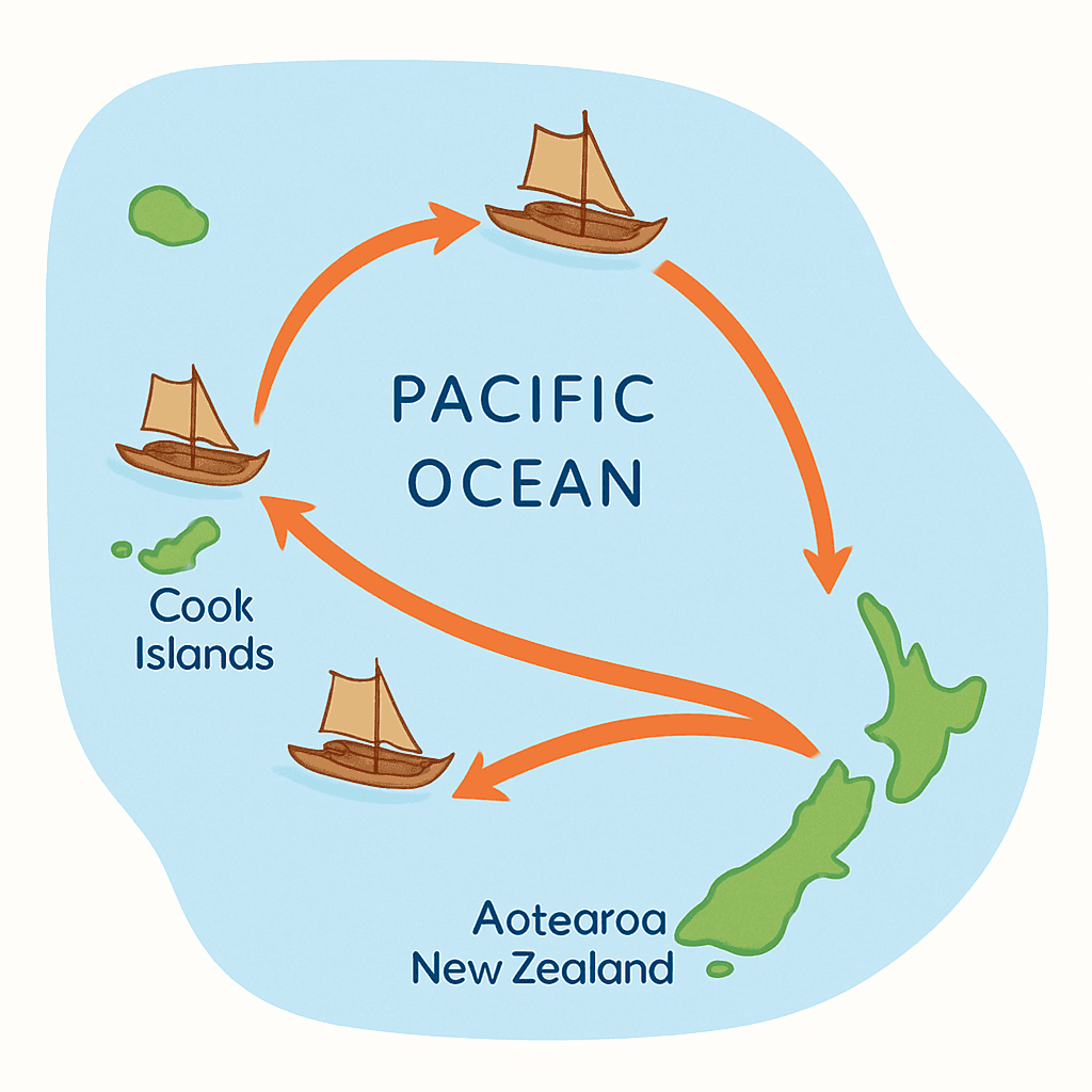
A simple map of the Pacific Ocean showing the ancestral migration routes of Polynesian voyagers from islands like Tahiti and the Cook Islands to Aotearoa New Zealand, with arrowed paths and small canoes.
How to use
- 1Right-click the image and choose “Save image as”, or use the download button.
- 2Use it in your classroom worksheets, slides or printables — free under CC BY-NC 4.0.
- 3Attribute as “Image by Kuraplan” or link back to kuraplan.com. Not for commercial resale.
Make worksheets with images like this
Kuraplan's editor has the full image library built in — drag-and-drop into a worksheet in seconds.
Browse by subject
16 subjects · 4,571 free illustrations

Maths
1,788 free illustrations

Cross-Curricular
602 free illustrations

English
557 free illustrations

Science
555 free illustrations
Geography
454 free illustrations

Religious Education
163 free illustrations
Music
146 free illustrations

Health
106 free illustrations

Drama
67 free illustrations

Art
61 free illustrations

social_studies
21 free illustrations

pe
21 free illustrations
tech
16 free illustrations

culture
8 free illustrations
te_reo_maori
5 free illustrations

languages
1 free illustrations