World Climate Zones — free printable diagram
Free geography resource for teachers · CC BY-NC 4.0
About this illustration
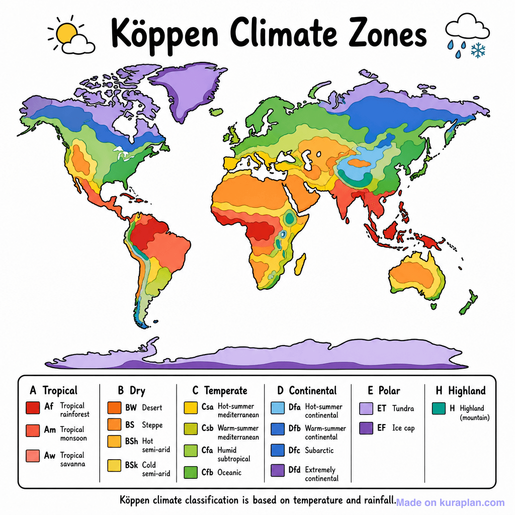
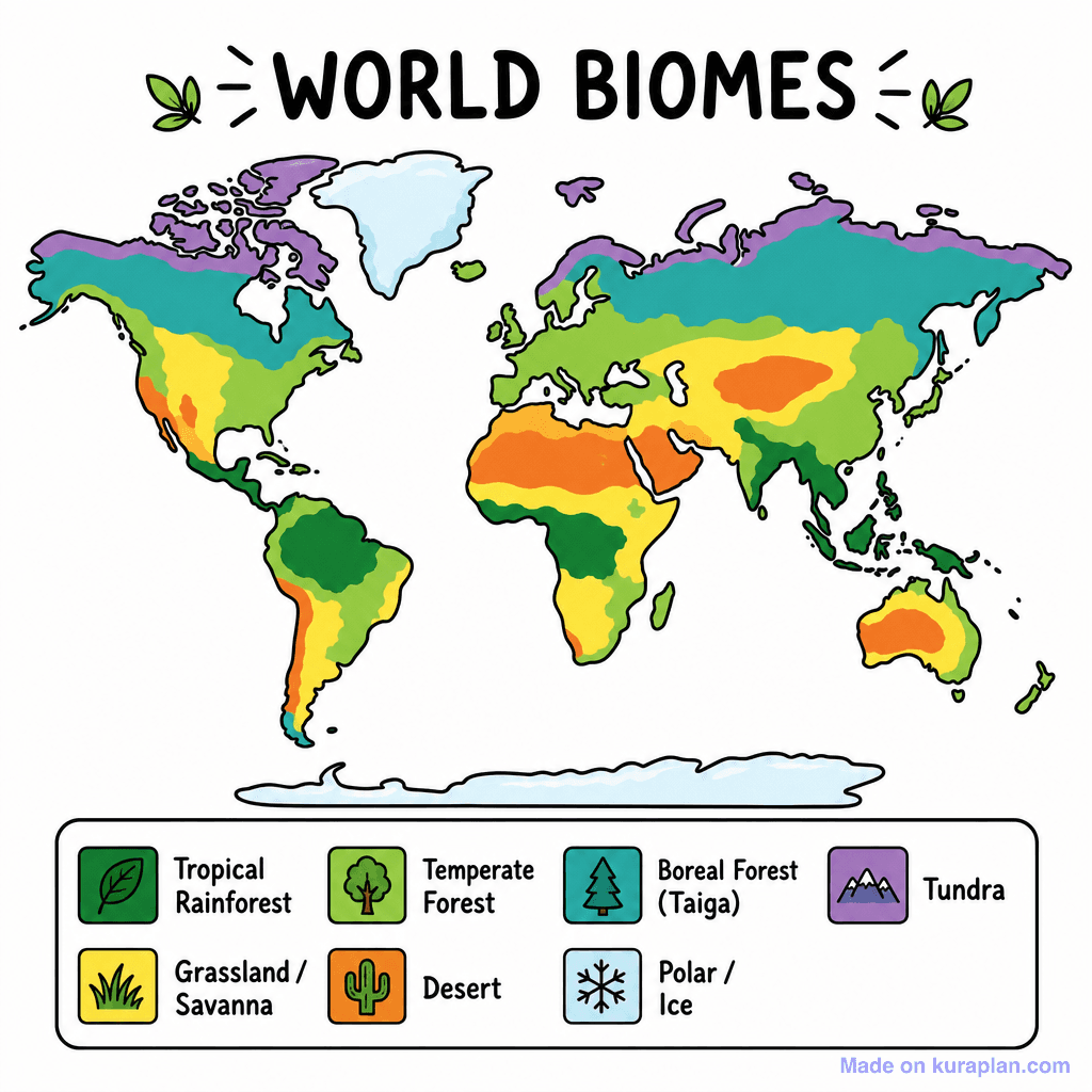
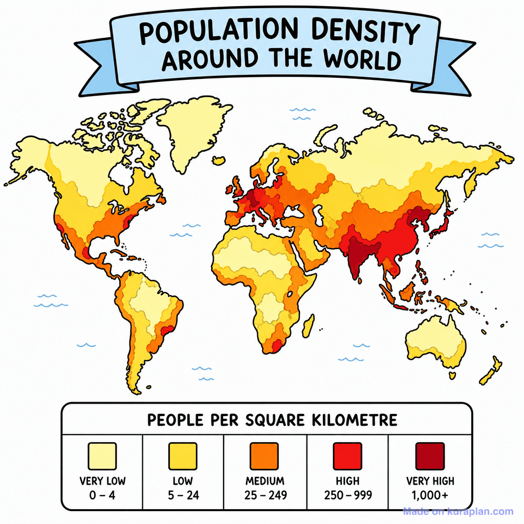
This image presents a brightly colored world map illustrating the Köppen Climate Zones, a system for classifying global climates. Continents are depicted in various shades, corresponding to specific climate types, all clearly outlined with black borders. A comprehensive legend below the map categorizes climate types into main groups (Tropical, Dry, Temperate, Continental, Polar, Highland) and their sub-classifications, along with color swatches. The bottom explicitly states that the classification is based on temperature and rainfall. This flat illustration is ideal for a geography or environmental science slide presentation, a classroom poster, or as a reference chart for worksheet activities on global climate patterns and climate classification.
How to use
- 1Right-click the image and choose “Save image as”, or use the download button.
- 2Use it in your classroom worksheets, slides or printables — free under CC BY-NC 4.0.
- 3Attribute as “Image by Kuraplan” or link back to kuraplan.com. Not for commercial resale.
Make worksheets with images like this
Kuraplan's editor has the full image library built in — drag-and-drop into a worksheet in seconds.
Related illustrations
More from World Maps (Thematic)
Browse by subject
10 subjects · 1,487 free illustrations


