World Political Map — free printable diagram
Free geography resource for teachers · CC BY-NC 4.0
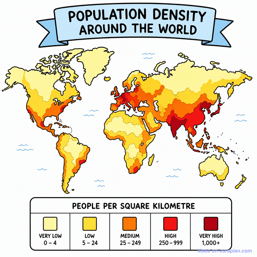
About this illustration
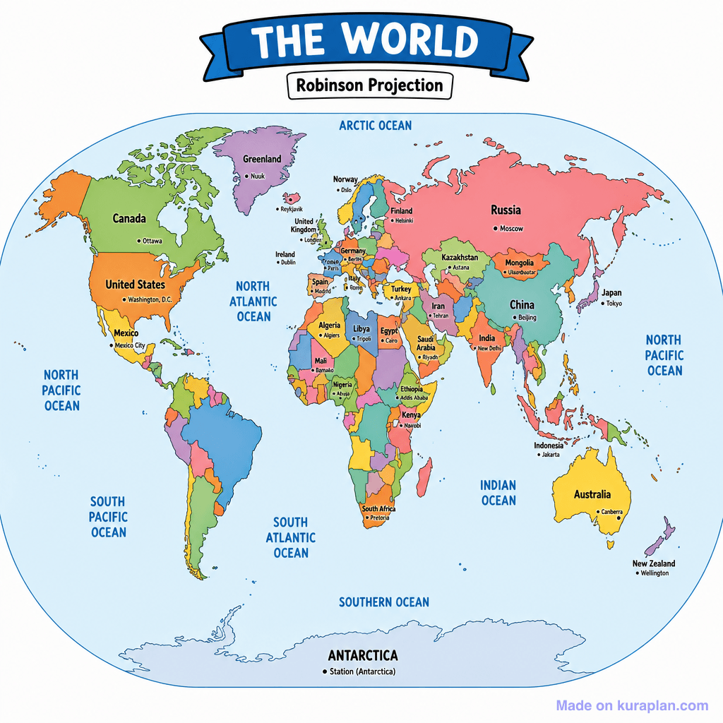
This is a vibrantly colored political world map, presented using the Robinson Projection, clearly depicting all major continents and their individual countries. Many significant countries are labeled with their names and capital cities, such as the 'United States' with 'Washington, D.C.' and 'Australia' with 'Canberra'. The major oceans are also prominently labeled, including the 'North Atlantic Ocean' and 'Indian Ocean'. This map is ideal for teaching global geography, country identification, and capital cities in a classroom setting, suitable for slide presentations, reference materials, or as a basis for label exercises. The visual style is a clear, flat illustration with distinct color coding for each country.
How to use
- 1Right-click the image and choose “Save image as”, or use the download button.
- 2Use it in your classroom worksheets, slides or printables — free under CC BY-NC 4.0.
- 3Attribute as “Image by Kuraplan” or link back to kuraplan.com. Not for commercial resale.
Make worksheets with images like this
Kuraplan's editor has the full image library built in — drag-and-drop into a worksheet in seconds.
Related illustrations
More from World Maps (Thematic)
Browse by subject
10 subjects · 1,487 free illustrations


